Col. Torrey DiCiro, deputy commander of the U.S. Army Corps of Engineers Northwest Division, talks as John Remus, chief of the corps' Missouri River Water Management Division in Omaha, walks to the podium during a public meeting on Missouri River management in October 2019 at the Betty Strong Encounter Center in Sioux City. The corps has announced that this fall's meetings will be held virtually because of the coronavirus pandemic.
Tim Hynds, Sioux City Journal file
Members of the public listen during a U.S. Army Corps of Engineers public meeting on Missouri River reservoir regulation Wednesday at the Betty Strong Encounter Center in Sioux City.
SIOUX CITY -- Record rainfall and runoff that caused flooding along the Missouri River in 2019 could lead to more flooding in 2020.
U.S. Army Corps of Engineers officials said they don't want to alarm everyone, but current conditions and weather forecasts point to a good chance that the river will run high again next year.
"We're looking at a higher probability of increased runoff. People need to be aware of the increased chances of flooding," John Remus, chief of the U.S. Army Corps of Engineers' Missouri River Water Management Division in Omaha, told an audience of about 125 people Wednesday evening at the corps' Missouri River Basin water management meeting at Sioux City's Betty Strong Encounter Center.
Just how the corps intends to deal with the expected wet conditions was asked of Remus more than once.
[Corps of Engineers official: Missouri River flood control measures need to be changed.]
Will the corps evacuate more water than usual during the winter or early spring from the river's six reservoirs to leave more room to catch spring runoff from snowmelt and rainfall?
Remus said the corps still must evacuate this year's water by March 1 in hopes of getting to a base storage level of 56.1 million acre-feet. It's unlikely that storage levels will be dropped lower than that, he said, but if conditions are right, the corps might push more water than normal through dams earlier in the year.
"If we have the opportunity to get more water out early next year, we will," Remus said. "We will be as aggressive as we can."
Corps officials showed the audience a series of maps and graphs that showed above-average rainfall this year across most of the Missouri River basin. South Dakota alone has experienced its wettest 12-month period in 121 years of record keeping. Other states aren't far behind. All that rain has left soil 99 percent saturated across much of the region.
"It doesn't get any greener than this," Kevin Grode, team leader of the corps' Reservoir Regulation Division, said, pointing to a map that showed, in varying shades of green, the soil moisture percentage.
The Iacinos from left, Aaron Iacino, Tera Iacino, and their children, Samuel Iacino, 11, Isabella Iacino, 13, and Tatiana Iacino, 9, watch the high water at Chris Larsen Park in Sioux City, Iowa on Saturday, March 16, 2019. Sioux City Journal Photo by Justin Wan
Joe Stanek of Sioux City looks at the rising Missouri River with his sons, Anthony, left, and Joseph, at Chris Larsen Park in Sioux City, Iowa on Saturday, March 16, 2019. Sioux City Journal Photo by Justin Wan
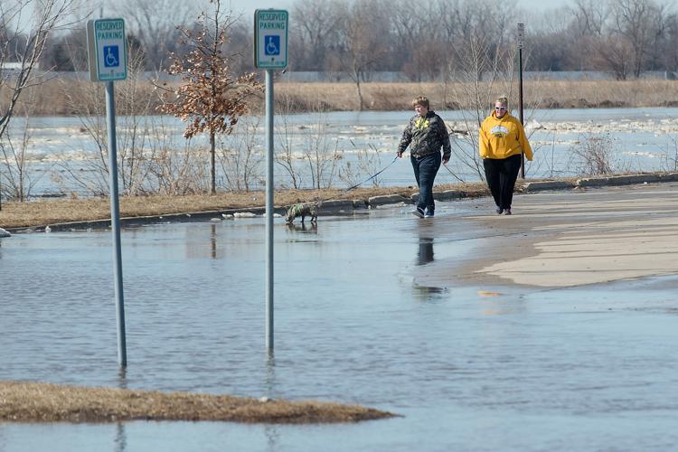
Joey Shockman of Jefferson, 14, and his mother Arlene Shockman walk the dog as the Missouri River takes over part of the parking lot at the boat ramp at Chris Larsen Park in Sioux City, Iowa on Saturday, March 16, 2019. Sioux City Journal Photo by Justin Wan
The rising Missouri River is seen taken over the sidewalk outside Cave restaurant at Chris Larsen Park in Sioux City, Iowa on Saturday, March 16, 2019. Sioux City Journal Photo by Justin Wan
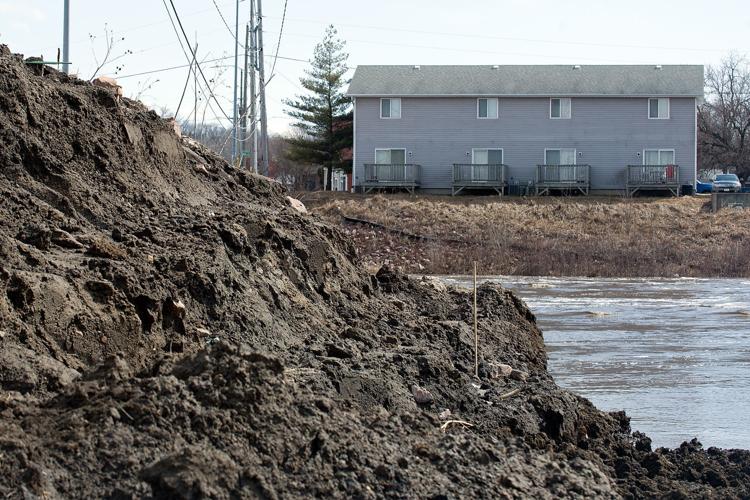
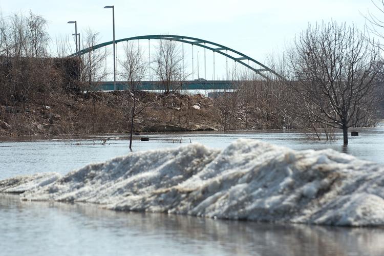
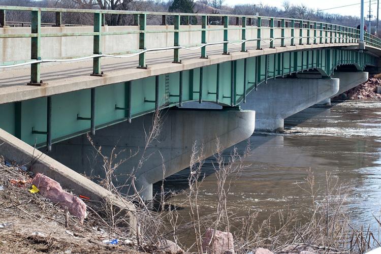
The Veterans Memorial Bridge and the rising Missouri River is seen at Chris Larsen Park in Sioux City, Iowa on Saturday, March 16, 2019. Sioux City Journal Photo by Justin Wan
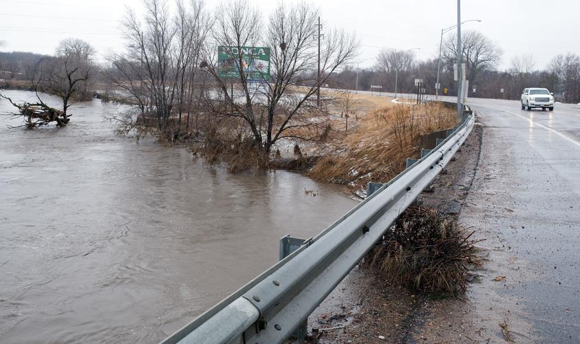
High water at Big Sioux River is seen beneath Military Road Bridge at North Sioux City is shown Saturday. Flooding fears for communities along the Big Sioux eased Wednesday as the National Weather Service sharply lowered projected crests for the river.
Heavy equipment is seen along the Big Sioux River ready to build up the temporary levy at North Sioux City, S.D. on Saturday, March 16, 2019. Sioux City Journal Photo by Justin Wan
The corps has forecast 2019 runoff to hit 61 MAF, which would tie 2011 for the highest runoff total in 121 years of record keeping. The annual average is 25.3 MAF.
The currently saturated soil won't soak up much of that runoff, leading to forecasts of runoff levels at twice the average amount through the remainder of the year. Soils are expected to be near their moisture capacity when they freeze this winter, leaving little ability to soak up water once the ground thaws in the spring.
Making matters worse is a National Weather Service forecast that shows a better-than-average chance of above-average precipitation from November through January.
[Read more: Missouri River will remain at high level into December.]
For now, the corps is focused on evacuating the 2019 runoff. Releases from Gavins Point Dam near Yankton, South Dakota, have been at 80,000 cubic feet per second -- more than twice the average rate for this time of year -- since September. Releases are expected to remain at that level until Dec. 1, when the corps will begin reducing them to 22,000 cfs for the winter by Dec. 15. If warmer weather persists into December, releases could remain higher for a little longer to evacuate more water. Normal winter releases are 17,000 cfs.
As of Monday, the amount of water stored in the Missouri River's six reservoirs was at 61.9 MAF, occupying 5.8 MAF of the 16.3 MAF of the system's flood storage capacity.
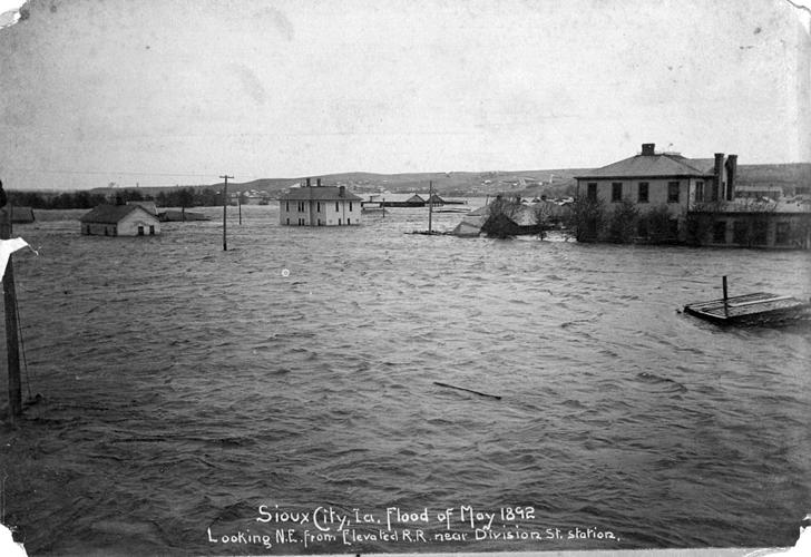
The May 18, 1892, Floyd River flood inundated homes, destroying residences for 3,000 residents and flooding businesses. This picture is looking northeast from the Division Street station.
Leeds residents use a boat to traverse the streets after the Floyd River flood in 1953. Floyd Avenue and other streets were flooded up to the Highway 75 viaduct. Reports said the Floyd River rose seven feet in two-and-a-half hours.
Leeds and the American Pop Corn Company were submerged in water from the Floyd River flood of 1953. The company bounced back rather despite the severe water damage and resumed normal operations by the end of the summer.
Police and volunteers place a blanket over the bodies of three flood victims recovered from two homes on Robinson Street in Springdale, the area hardest hit by the 1953 flood.
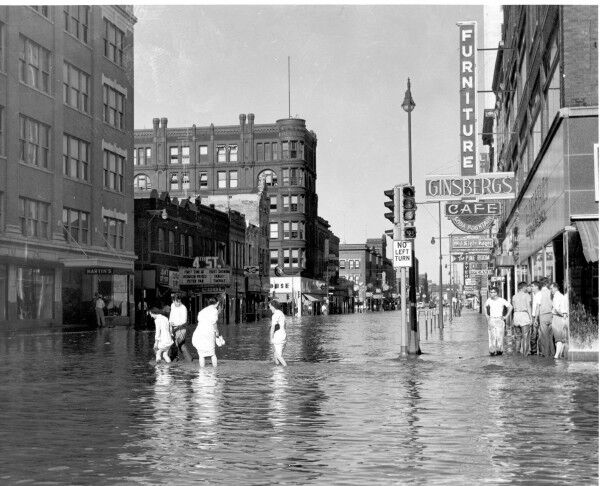
Shoppers wade through the Floyd River waters that reached downtown on June 8, 1953. The pedestrians are walking outside the T.S. Martin Department Store in this view looking east from Fourth and Nebraska streets.
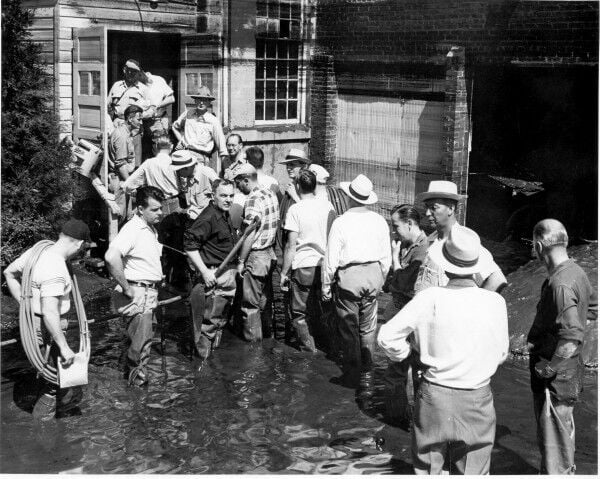
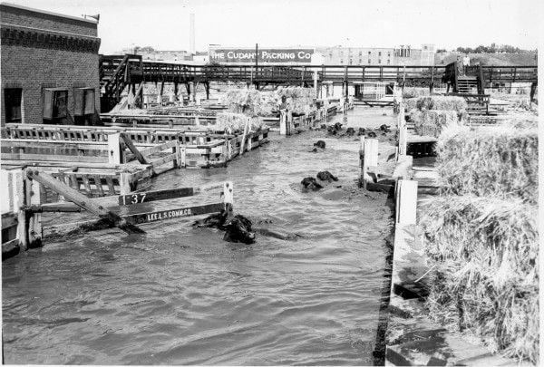
A cleaning crew enters the Wincharger Corp. plant at Seventh and Division streets after the June 8, 1953, Floyd River flood, which inundated many industries in the Floyd Valley. Floodwaters stretched from Leeds south to the Missouri River, east to downtown and west to Greenville.
An aerial photograph of the flooding Floyd River in the Leeds neighborhood after the June 8, 1953, flood. The photograph is looking southeast from the north end of Leeds.
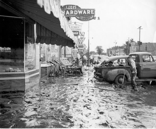
Byron Blackstone, right, stands in thick mud by the pickup truck as he begins cleaning up outside Leeds Hardware on June 9, 1953, one day after a wall of water struck the city. The photograph is looking north on Floyd Boulevard from 41st Street.
North Sioux City ordered the evacuation of the entire town of about 800 people in April 1969 as the swollen Big Sioux River poured into neighborhoods, above.
Aerial photograph shows the U.S. 77 bridge separating Riverside and flooded section of North Sioux City at right on April 10, 1969. Water was flowing swiftly under both bridges but neither was in immediate danger.
In the early hours of May 18, 1990, Perry Creek, swollen after downpours, spilled over. Many people left homes with only the clothes they were wearing and perhaps a pet.
In response to a question from the audience, Remus said the corps has been unable to increase releases from the reservoirs to higher levels this fall because of the continued above-average precipitation across the region that filled rivers such as the Vermillion, James and Big Sioux in South Dakota, the Little Sioux in Iowa and the Platte in Nebraska. Those rivers all feed into the Missouri beneath the reservoirs and have kept river levels high in Omaha and points south, limiting the progress on levee repairs in southwest Iowa, southeast Nebraska and Missouri.
"We're doing everything we can to manage the flood and move on to recovery from flooding," said Col. Torrey DiCiro, deputy commander of the Corps of Engineers Northwestern Division.
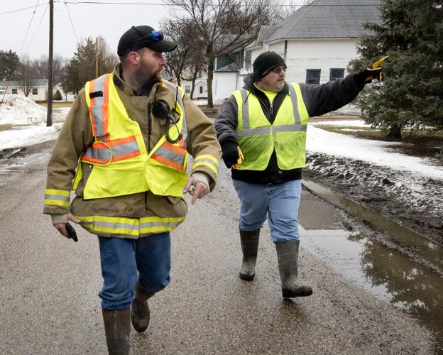
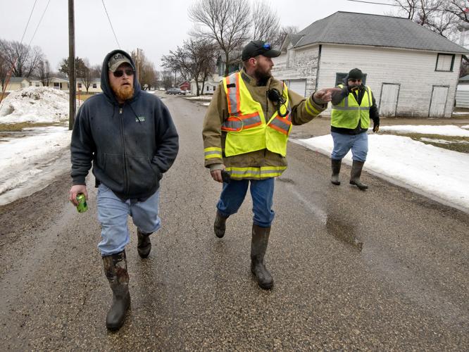
Ben Ronfeldt, left, assistant Hornick Fire Chief, and Don Payne go door-to-door to evacuate residents Thursday in Hornick. An evacuation order for the town was issued when a levee holding back the West Branch of the Little Sioux River was breached.
Shannen Platzeck loads her dog, Yoda, into a car Thursday in Hornick after an evacuation order for the town was issued when a levee holding back the West Branch of the Little Sioux River was breached.
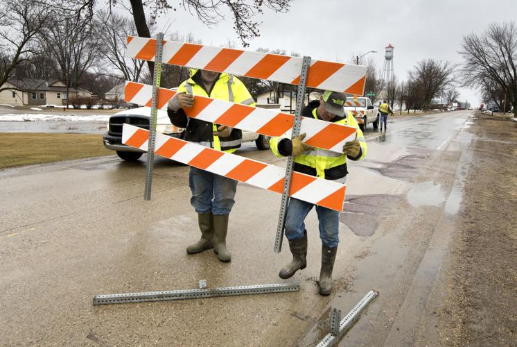
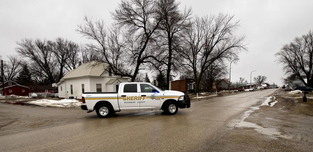
Woodbury County roads workers put up a barricade at the north edge of Main Street in Hornick, Iowa, on March 14, 2019, after an evacuation order for the town was issued when a levee holding back the West Branch of the Little Sioux River was breached.
A Woodbury County sheriff's deputy drives on Main Street Thursday, March 14, 2019, in Hornick, Iowa, after an evacuation order for the town was issued when a levee holding back the West Branch of the Little Sioux River was breached.
Firefighters prepare to go door-to-door to warn people Thursday, March 14, 2019, in Hornick, Iowa, after an evacuation order for the town was issued. The evacuation was ordered after a levee holding back the West Branch of the Little Sioux River was breached.
Ben Ronfeldt, center, assistant Hornick Fire Chief, Matt Andresen, left, and Don Payne, go door-to-door to evacuate residents Thursday, March 14, 2019, in Hornick, Iowa. An evacuation order for the town was issued when a levee holding back the West Branch of the Little Sioux River was breached.
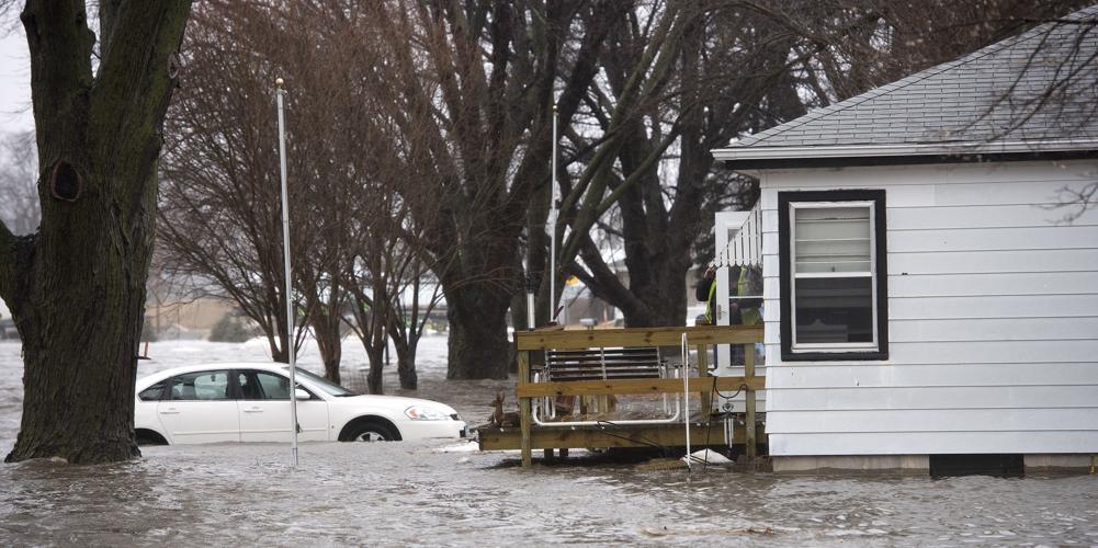
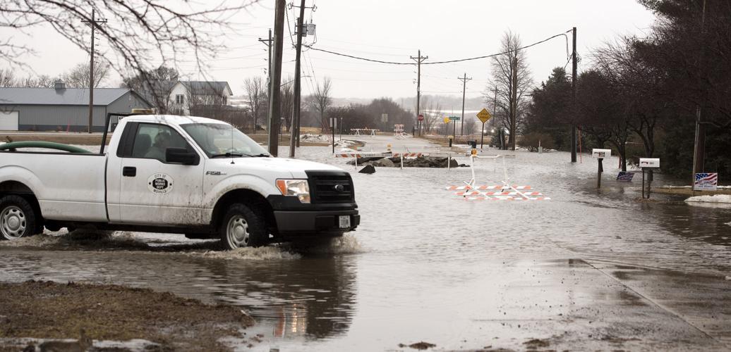
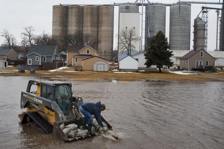
Water encroaches on the home of Matt Hager on 1st Street in Moville, Iowa, Thursday, March 14, 2019. Floodwaters from the West Fork of the Little Sioux River inundated Moville.
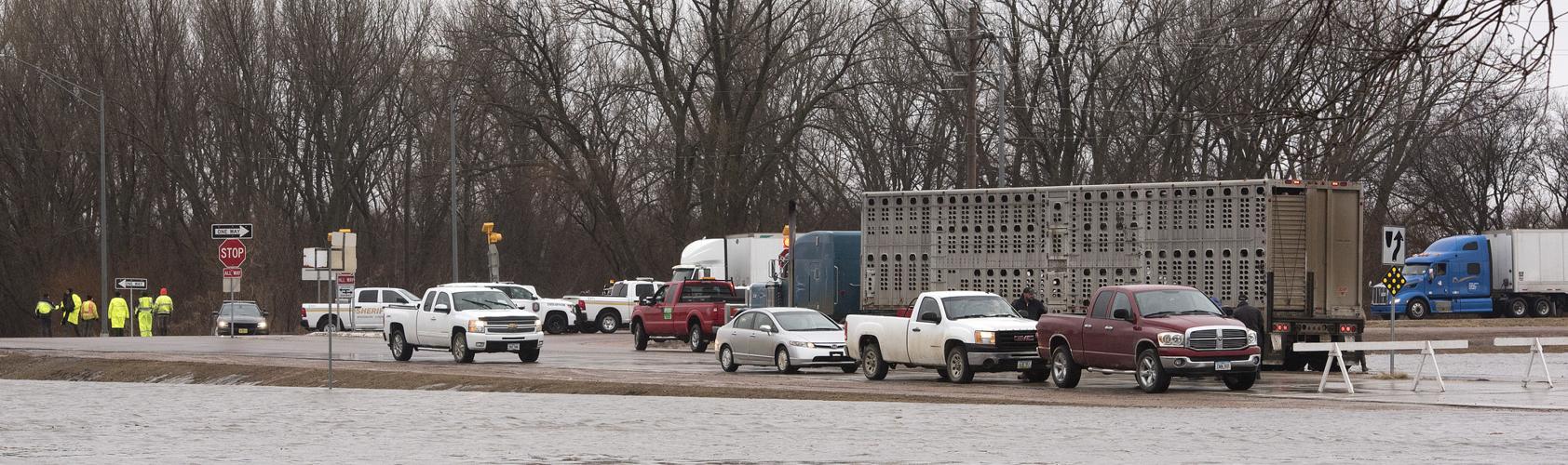
Law enforcement officers block the intersection of U.S. Highway 20 and 1st Street in Moville on March 14 as floodwaters from the West Fork of the Little Sioux River inundate the Woodbury County town. Nearly 400 county residents had registered for disaster assistance from the Federal Emergency Management Agency as of Monday.
Zuri Vickery, 6, foreground, Tanner Mackey and Mackenzie Hamman, right, look at floodwaters Thursday, March 14, 2019, from the intersection of Miller Blvd and 1st Street in Moville, Iowa, as floodwaters from the West Fork of the Little Sioux River inundate the city.
Anhydrous ammonia tanks and grain wagon are shown Thursday, March 14, 2019, as floodwaters from the West Fork of the Little Sioux River inundate Moville, Iowa.
Chucks of ice that came from Mud Creek floodwaters litter a field of corn stubble Thursday, March 14, 2019, along County Road D-12 northwest of Moville, Iowa.
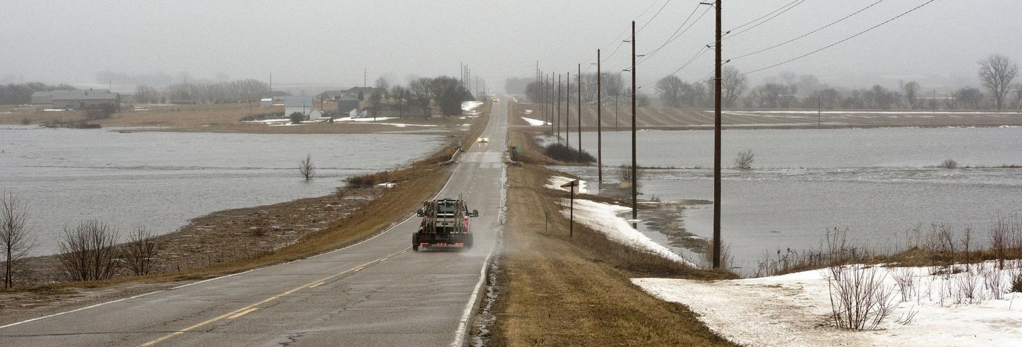
The West Fork of the Little Sioux River is shown out of its banks March 14 north of Moville, Iowa. The Federal Emergency Management Agency has granted Iowa’s request for an extension of the registration deadline for flood victims in nine Iowa counties, including Woodbury and Monona, to apply for the federal Individual Assistance Program. The new deadline is July 16.
City workers drive through water on the north side of Moville Thursday, March 14, 2019, as floodwaters from the West Fork of the Little Sioux River inundate Moville, Iowa.
A grain trailer and semi-tractor are surrounded by water Thursday, March 14, 2019, as floodwaters from the West Fork of the Little Sioux River inundate Moville, Iowa.
Aowa Creek is shown in Ponca, Neb. on Thursday. The swollen creek caused flooding of streets and residential basements in the south end of Ponca on Wednesday, but by Thursday much of the flooding had receded.
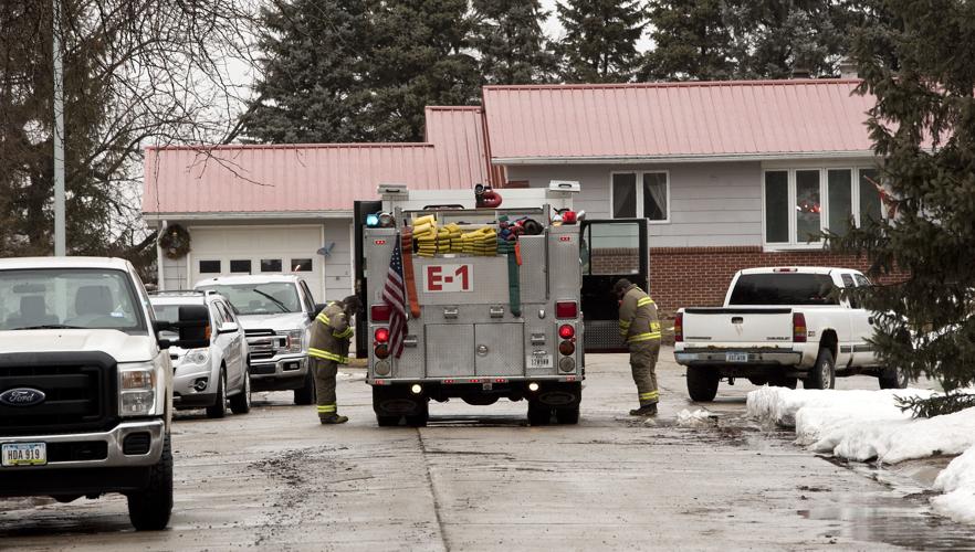
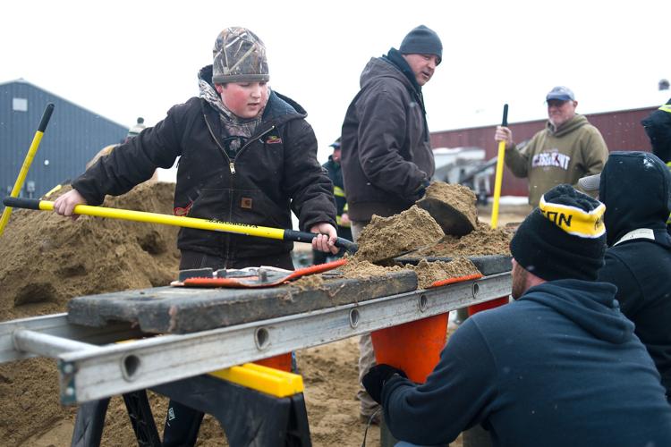
Workers, including Hinton firefighter Ben Hertenstein, third from left, gather sandbags in Hinton, Iowa on Thursday, March 14, 2019. Sioux City Journal Photo by Justin Wan
Photos: Flood preparations and recovery across Siouxland
Dakota Dunes sandbagging
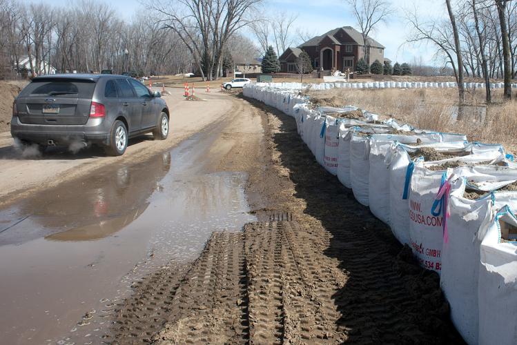
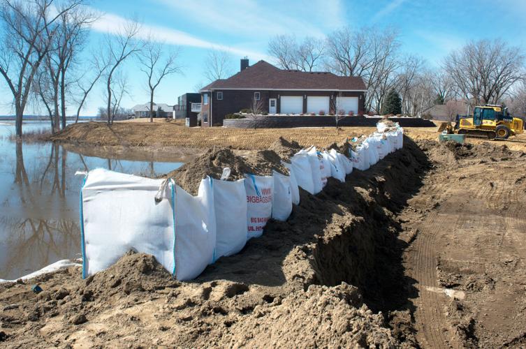
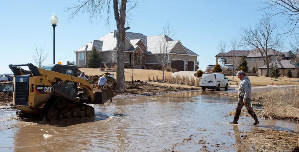
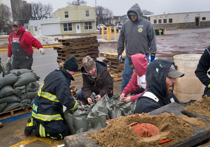
Contractors fill sandbags Friday in Dakota Dunes on Pebble Beach Drive near the interection of Spanish Bay. Many of the homes on the street are on the Missouri River riverfront. The river is expected to rapidly rise above flood stage this weekend due to upstream flood and increased releases from Gavins Point Dam in Yankton, South Dakota.
Tim Hynds, Sioux City Journal
Flooding Pender
Flooding is shown on the 500 block of Willis Street in Pender, Neb., in this March 15 file photo. Nebraska state emergency officials who faced record floods this year are now scrambling to boost their ranks with more workers to help residents recover and rebuild their communities.
Justin Wan, Sioux City Journal
Flooding Pender
The 500 block of Willis Street in Pender, Nebraska remained flooded Friday.
Justin Wan, Sioux City Journal
Flooding Pender
Traffic on Fourth Street flows freely after the north flood gate was taken down Friday morning in Pender, Nebraska.
Justin Wan, Sioux City Journal
Flooding Pender
Mud and debris are seen on the road in Pender, Neb. on Friday, March 15, 2019. Sioux City Journal Photo by Justin Wan
Justin Wan, Sioux City Journal
Flooding Pender
Mud and debris are seen on the road in Pender, Neb. on Friday, March 15, 2019.
Justin Wan, Sioux City Journal
Flooding Pender
Traffic on Fourth Street flows freely after the flood gate was taken down earlier in the morning in Pender, Neb. on Friday, March 15, 2019. Sioux City Journal Photo by Justin Wan
Justin Wan, Sioux City Journal
Flooding Pender
A bridge over Logan Creek on Nebraska Highway 94 just east of Pender, Neb., that had been closed since it was damaged by flooding on March 14 will reopen on Saturday.
Justin Wan, Sioux City Journal file
Flooding Pender
A worker with City of Pender closes the bridge on Main Street crossing Logan Creek Dredge in Pender, Neb. on Friday, March 15, 2019. Sioux City Journal Photo by Justin Wan
Justin Wan, Sioux City Journal
Flooding Pender
Crystal Scarlett and Loren Morgan of Pender, Nebraska take photos and inspect the damaged bridge on Main Street crossing Logan Creek Dredge in Pender on Friday. The village was virtually surrounded by flooding this week. The town's east flood wall will remain in place until a state mandated inspection of the damaged bridge is completed. The north flood wall was taken down Friday, allowing traffic on Highway 9 to reopen.
Justin Wan, Sioux City Journal
Flooding Pender
The bridge on Main Street crossing Logan Creek Dredge remained closed in Pender, Neb. on Friday, March 15, 2019. Sioux City Journal Photo by Justin Wan
Justin Wan, Sioux City Journal
Dakota Dunes sandbagging
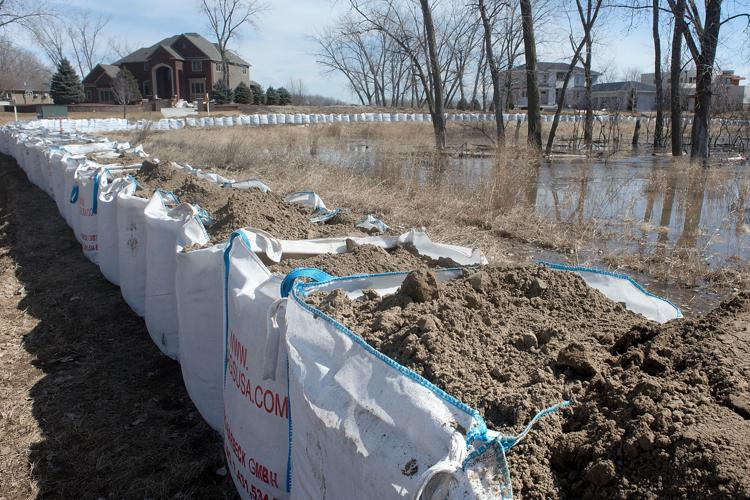
Contractors fill sandbags March 15 in Dakota Dunes on Pebble Beach Drive near the intersection of Spanish Bay. South Dakota and federal officials have scheduled a flood insurance assistance meeting for April 9 in North Sioux City.
Tim Hynds, Sioux City Journal file
Flooding Preparations Sioux City
Workers pump out water from a drain near Lewis & Clark Interpretive Center in Sioux City Friday.
Justin Wan, Sioux City Journal
Flooding Preparations Sioux City
Todd Kron of Sioux City Parks and Recreation packs Hesco barriers to protect a water pump at Chris Larsen Park in Sioux City, Iowa on Friday, March 15, 2019. Sioux City Journal Photo by Justin Wan
Justin Wan, Sioux City Journal
Flooding Preparations Sioux City
Workers pack Hesco barriers to protect a water pump at Chris Larsen Park in Sioux City, Iowa on Friday, March 15, 2019. Sioux City Journal Photo by Justin Wan
Justin Wan, Sioux City Journal
Flooding Preparations Sioux City
Fishing regular Adam Belt of Sioux City takes advantage of the rising water at the boat dock at Chris Larsen Park in Sioux City, Iowa on Friday, March 15, 2019. Sioux City Journal Photo by Justin Wan
Justin Wan, Sioux City Journal
Sioux City flooding preparation
A city worker uses a gauge station on the Sixth Street bridge to measure the depth of the Floyd River in Sioux City, Iowa, Friday, March 15, 2019. The river is swollen from upstream floodwaters.
Tim Hynds, Sioux City Journal
Sioux City flooding preparation
Upstream floodwaters churn in the Floyd River Friday from the Fourth Street bridge looking south towards the Missouri River.
Tim Hynds, Sioux City Journal
Sioux City flooding preparation
City workers sandbag a restroom near the Missouri River boat ramp in Sioux City's Chris Larsen Park Friday. Workers were shoring up infrastructure along the waterfront in preparation for possible flooding. Residents of Dakota Dunes and other residential areas in southeast South Dakota have been asked to prepare to voluntarily evacuate due to the rising river.
Col. Torrey DiCiro, deputy commander of the U.S. Army Corps of Engineers Northwest Division, talks as John Remus, chief of the corps' Missouri River Water Management Division in Omaha, walks to the podium during a public meeting on Missouri River management in October 2019 at the Betty Strong Encounter Center in Sioux City. The corps has announced that this fall's meetings will be held virtually because of the coronavirus pandemic.
Members of the public listen during a U.S. Army Corps of Engineers public meeting on Missouri River reservoir regulation Wednesday at the Betty Strong Encounter Center in Sioux City.